
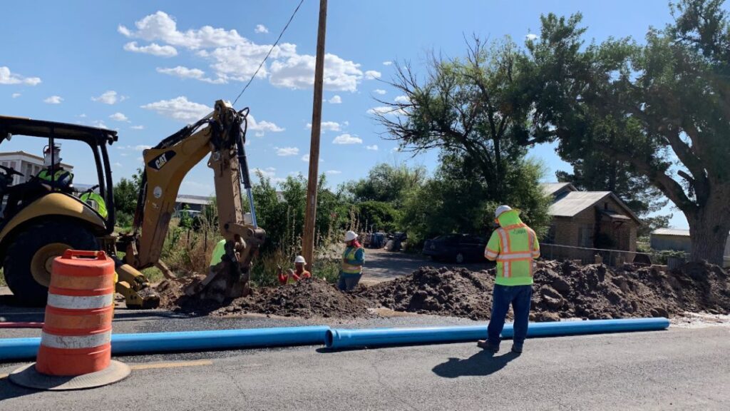
Utility mapping is a critical component in the planning and execution of infrastructure projects. It involves locating, identifying, and depicting existing utilities such as water, gas, electricity, and telecommunications. The complexity of modern infrastructure necessitates this meticulous process to ensure safety, efficiency, and cost-effectiveness.
Understanding Utility Mapping
Utility mapping is more than just identifying where pipes and cables are buried. It requires an extensive understanding of the various utility systems and their interactions with each other and the surrounding environment. The primary goal of utility mapping is to create a clear, accurate representation of utility infrastructure that aids in effective project planning and execution.
As infrastructure projects become increasingly complex due to urbanization and technological advancements, accurate utility maps are crucial. They allow engineers, planners, and contractors to foresee potential conflicts and mitigate risks associated with utility relocations and installations. The integration of utility mapping into the early stages of project design can significantly enhance the overall efficiency of the construction process, ensuring that all utility considerations are addressed before any physical work begins.
Moreover, utility mapping enhances communication among various stakeholders such as city planners, utility companies, and contractors. By providing a shared visual representation of underground utilities, all parties can make informed decisions, ultimately leading to streamlined workflows and reduced project timelines. This collaborative approach not only fosters transparency but also promotes a culture of safety, as everyone involved has access to the same critical information regarding the utility landscape.
The Importance of Accurate Utility Mapping
Accurate utility mapping significantly reduces the risk of accidents during construction. Striking an underground utility line can lead to catastrophic results, including service interruptions, costly repairs, or even injury to workers. By understanding the precise locations of utilities, project teams can plan excavation and other activities more safely. Additionally, accurate mapping can help in the identification of aging infrastructure, which may require upgrades or replacements, thereby preventing future complications.
This accuracy is also vital for compliance with local regulations and guidelines that govern construction projects. Many jurisdictions require thorough utility mapping as part of the permitting process to prevent disruptions and enhance public safety. Furthermore, accurate utility mapping can facilitate better emergency response planning, allowing first responders to quickly locate and address utility-related incidents, thereby minimizing potential hazards to the public.
Techniques Used in Utility Mapping
Several techniques are employed to create accurate utility maps. Ground Penetrating Radar (GPR) is one of the most common methods, utilizing radar pulses to image underground utilities. Electromagnetic location tools can detect metallic utilities by inducing a current in them, allowing for precise tracking. These advanced technologies not only improve the accuracy of utility mapping but also reduce the time and labor required compared to traditional methods.
Additionally, traditional methods such as surveying and consulting utility records are still employed. However, these methods may not always provide the most accurate representation, emphasizing the need for modern technology in utility mapping. The integration of Geographic Information Systems (GIS) further enhances utility mapping by allowing for the layering of various data sets, including topography, land use, and existing infrastructure, which can provide deeper insights into the utility landscape. This holistic approach ensures that all relevant factors are considered, leading to more informed decision-making throughout the project lifecycle.
Benefits of Utility Mapping in Infrastructure Projects
The benefits of effective utility mapping extend beyond merely avoiding mishaps; they encompass cost savings, enhanced project efficiency, and improved collaboration among stakeholders. Identifying utility assets early in the project allows teams to allocate resources better and avoid costly delays. Moreover, having a clear understanding of existing utilities can also lead to innovative design solutions, as engineers and architects can work around existing infrastructure rather than making last-minute adjustments that could derail timelines.
Furthermore, having an up-to-date utility map can aid in future planning and maintenance. As cities evolve, so do their utility needs. A comprehensive utility map serves as a valuable resource for town planners and policymakers who seek to make informed decisions about urban development. This foresight can lead to more sustainable practices, as planners can identify areas where utility upgrades are necessary, thereby ensuring that infrastructure keeps pace with population growth and technological advancements.
Cost Reduction and Risk Management
One of the most significant advantages of utility mapping is the potential for cost reduction. By preventing utility strikes, projects can avoid expensive repairs and legal fees associated with service interruptions. Furthermore, utility mapping can help in accurately budgeting for projects, as unforeseen complications can lead to increased expenses. The initial investment in utility mapping can yield significant returns, as it mitigates the risk of unexpected financial burdens that can derail entire projects.
Effective risk management is another substantial benefit. With accurate utility maps, project managers can conduct thorough risk assessments and develop contingency plans, ensuring that any issues can be swiftly and efficiently addressed. This proactive approach minimizes downtime and stabilizes project timelines. Additionally, the ability to anticipate and plan for potential challenges allows teams to allocate resources more effectively, ensuring that skilled labor and materials are available when needed, further enhancing project efficiency. Visit https://realestatecentralcoast.com/pipe-location-services-how-they-prevent-costly-repairs/ to get how pipe location services prevent costly repairs.
Enhancing Collaboration Among Stakeholders
Utility mapping fosters collaboration between various stakeholders, including utility companies, contractors, and government agencies. When all parties have access to the same detailed utility maps, it helps in synchronizing efforts and streamlining communication. This collective understanding reduces the likelihood of misunderstandings and conflicts, enhancing overall project cohesion. The integration of advanced technologies, such as Geographic Information Systems (GIS), can further enrich this collaboration by providing real-time data updates and visualizations that all stakeholders can easily access and interpret.
Additionally, the use of shared utility maps promotes transparency. Stakeholders can openly discuss potential challenges and work collaboratively toward solutions. This united front can significantly enhance the efficiency and success of the infrastructure project. Furthermore, the collaborative environment fostered by utility mapping can lead to innovative problem-solving, as diverse perspectives come together to address complex issues. By leveraging the expertise of various stakeholders, projects can benefit from a wealth of knowledge that might otherwise remain untapped, ultimately leading to more resilient and effective infrastructure solutions.
Challenges in Utility Mapping
Despite its numerous benefits, utility mapping does present some challenges. One major issue is the availability and reliability of existing utility data. In many cases, utility companies may not have up-to-date records, leading to gaps in accurate mapping.
Furthermore, varying standards and regulations across different jurisdictions can complicate utility mapping efforts. Project teams must ensure that they adhere to local guidelines while also striving for consistency in the utility mapping process.
Addressing Data Gaps and Inconsistencies
To address data gaps, it is essential for utility companies to invest in higher-quality data management and mapping systems. Collaboration between utility providers and construction teams can create more reliable data sets that enhance mapping accuracy.
Training and educating personnel on the importance of accurate utility mapping is equally important, ensuring that all stakeholders recognize the relevance of their contributions to overall project success. By fostering a culture of continuous improvement, utilities can better manage their data and enhance mapping efforts.
Staying Abreast of Technological Advancements
Technological advancements in utility mapping are constantly evolving, providing newer and more accurate methods of identifying underground utilities. Staying updated with these advancements can present a challenge for companies that may not have the resources to implement cutting-edge techniques.
Companies must invest in ongoing education and training for their teams, ensuring they are equipped to utilize the latest technologies effectively. This investment can pay dividends in terms of enhanced safety, reduced costs, and improved project outcomes.
Conclusion
In summary, utility mapping is an essential step in infrastructure projects that should not be overlooked. Accurately locating and understanding utility networks enhances safety, efficiency, and collaboration among all stakeholders. As urbanization continues and demands on infrastructure grow, the importance of utility mapping will only increase. Embracing cutting-edge technologies and methodologies will further advance the discipline, ensuring that infrastructure projects are safer and more efficient. The future of infrastructure relies on understanding what lies beneath the surface, making comprehensive utility mapping more important than ever.